


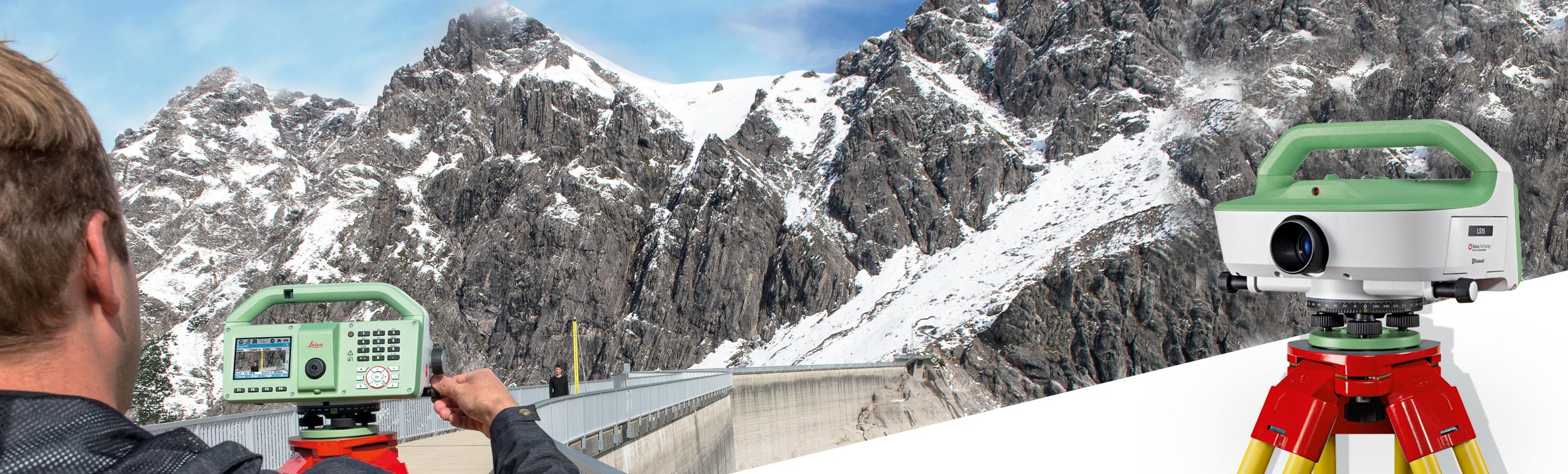
Leica LS15
The Leica LS15 and Leica LS10 digital levels improve demanding levelling tasks anywhere. Their automatic functions and market-leading 0.2 mm accuracy allow users to easily demonstrate their measuring skills while effectively completing any project.
Request more information
Leica LS15 Digital Level
From autofocus to the touchscreen with its clear displays: the entire measurement process becomes more efficient with the LS15 and LS10 digital levels. Common levelling errors, such as staff reading mistakes, are a thing of the past. Our levelling solutions offer the most reliable and understandable results through colour image workflows, making the daily tasks of professionals more enjoyable.
Users benefit from the experience of Leica Geosystems as the creator and market leader of digital levels. These solutions, which perfect the digital level into a form of art, record results faster and with the highest possible precision.
Endless Possibilities
The experience with Leica Geosystems LS digital levels does not end in the field. After transferring your data to the office in the simplest way, Leica Infinity processes your results without any complications. This intuitive software understandably displays complex levelling data.
Customer Care at a Single Click
Through Active Customer Care, you can access a global network of qualified professionals with a single click, who will guide you to solve any problem:
- Eliminate delays thanks to superior technical service.
- Finish jobs faster with excellent consultancy services.
- Avoid costly site revisits thanks to online services for sending and receiving data directly from the field.
Control your expenses with a personalised Customer Care Package, giving you the peace of mind of being covered everywhere and at any time.
Leica Geosystems LS15 Optical Level. Maximum precision levelling.

