




Artec Jet
Mobile LiDAR scanner with SLAM positioning for capturing full-scale environments. It operates outdoors, underground, in the air and in complete darkness—without GPS, connectivity or environmental limitations.
| 1.9 million points per second | Up to 5–10 mm global accuracy | From 0.5 to 300 m scanning range |
Request more information
A SLAM scanner for any environment
The Artec Jet is built around a simple idea: the size of the project should not determine which equipment you carry in your backpack. Its high-density LiDAR sensors, combined with real-time SLAM positioning algorithms, make it possible to capture entire environments—industrial plants, tunnels and building façades—with the same ease that other scanners capture individual objects.
Unlike traditional mapping systems, the Artec Jet does not depend on GPS or an internet connection to operate. The device calculates its own position using the LiDAR data it captures, allowing it to work in underground car parks, mines, warehouses and all types of indoor environments without compromising accuracy.
The result is a digital twin of the environment with an indoor accuracy of ±10 mm and the ability to detect variations as small as 5 mm, making it suitable for documenting structural settlement, deformation or changes between two visits to the same site.
Seven deployment methods
The Artec Jet is not limited to a single operating mode. Its SLAM algorithms remain equally robust regardless of how the device is transported, making it a single solution capable of replacing a complete set of specialised equipment.
It can be used:
- Handheld
- In a backpack
- On a drone
- Mounted on a vehicle
- With a protective cage
- With a telescopic pole
- Through robotic integration

Autonomous pilot-free flight
The most distinctive feature of the Artec Jet is its ability to scan completely autonomously while mounted on a drone. With no need for manual piloting, the system plans its own flight paths, avoids obstacles as small as 2 mm in diameter, such as cables, and maintains a stable position while collecting mapping data.
This makes it possible to access locations where sending a person would involve a genuine risk: unstable tunnels, structures at risk of collapse, spaces with hazardous atmospheres or areas that are simply too confined for conventional drone operation. If the battery level falls below the safe threshold, the drone automatically returns to its launch point.
The Artec Jet can also operate in complete darkness. Because it relies on LiDAR rather than structured light or conventional colour cameras, the absence of lighting does not affect the quality of the captured data. Optional video cameras can add colour texture whenever conditions allow.
Designed for real-world environments
With IP65 protection against dust and water and an operating temperature range from -10°C to 45°C, the Artec Jet is designed for uncontrolled environments. It weighs 1.57 kg, making it easy to handle during long capture sessions, whether carried on foot or mounted on a drone or vehicle.
The companion app provides real-time feedback and on-site verification, allowing the operator to confirm that sufficient coverage has been achieved before leaving the site. Its 360° × 290° field of view ensures that no blind spots are left during a single pass.
| Accuracy (indoor / underground) | ±10 mm |
| Minimum detectable change | 5 mm |
| Field of view | 360° × 290° |
| Weight | 1.57 kg |
| Protection rating | IP65 |
| Operating temperature | -10°C to 45°C |
| Positioning | SLAM + optional RTK/GNSS |
| Colour capture | Optional video cameras |
| Autonomous mode | Autonomous drone with integrated AI |
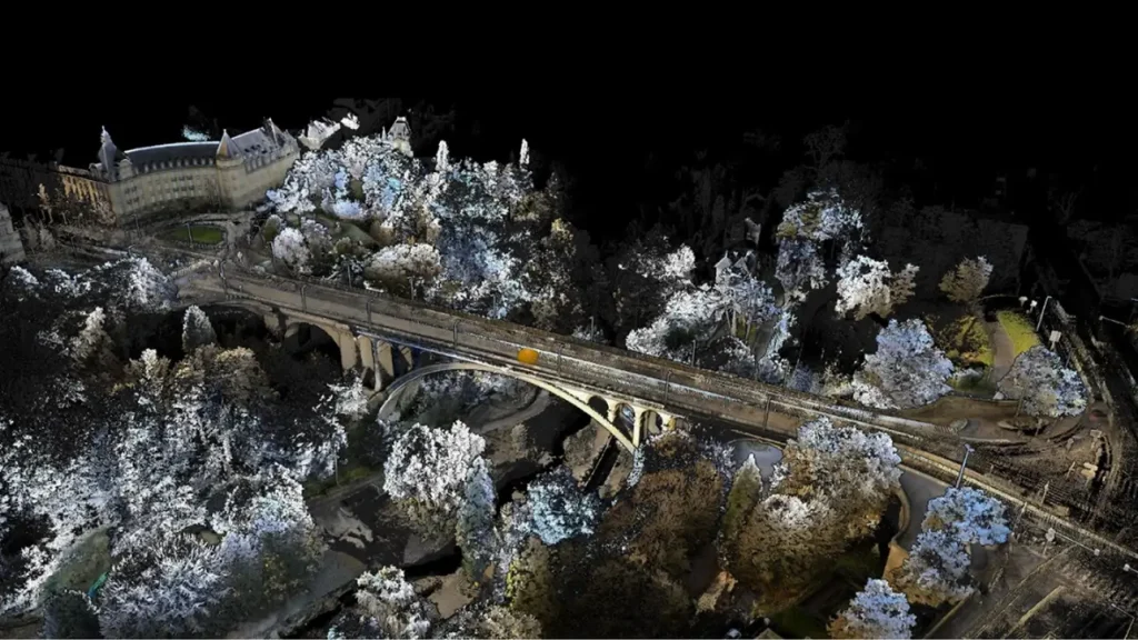
Artec Jet application sectors
The Artec Jet fits into any workflow where the accuracy of the physical environment matters at building or infrastructure scale. Its combination of autonomy, robustness and precision makes it particularly valuable for projects where access is difficult or time on site is limited.
- Architecture and civil engineering: Creation of as-built surveys for existing buildings, documentation before and after construction work, and monitoring of structural deformation over time. The Artec Jet can capture complete floors in a single session without fixed stations or control points.
- Mining: Inspection of galleries, excavation faces and restricted-access areas where GPS is unavailable and lighting is limited or non-existent. Autonomous drone operation makes it possible to send the scanner into areas at risk of rockfall without exposing personnel.
- Defence and inspection: Site reconnaissance, forensic documentation of scenes and inspection of facilities under controlled-access conditions. Autonomous operation and the ability to work without connectivity are particularly valuable in sensitive environments.
- Industrial plants: Digitisation of active facilities for predictive maintenance, detection of deviations from the original design and planning of extensions. Vehicle mounting makes it easier to cover large industrial buildings in a short time.
- Oil & Gas: Periodic inspection of refineries, platforms and pipeline networks where detecting millimetre-level changes may reveal corrosion or material fatigue. Autonomous drone operation reduces personnel exposure to environments containing gases or high electrical risk.
- Critical infrastructure: Bridges, dams, power stations and sewer networks require regular inspections under difficult conditions. The Artec Jet provides an accurate geometric record that can be compared with previous measurements to detect variations before they become serious problems.