


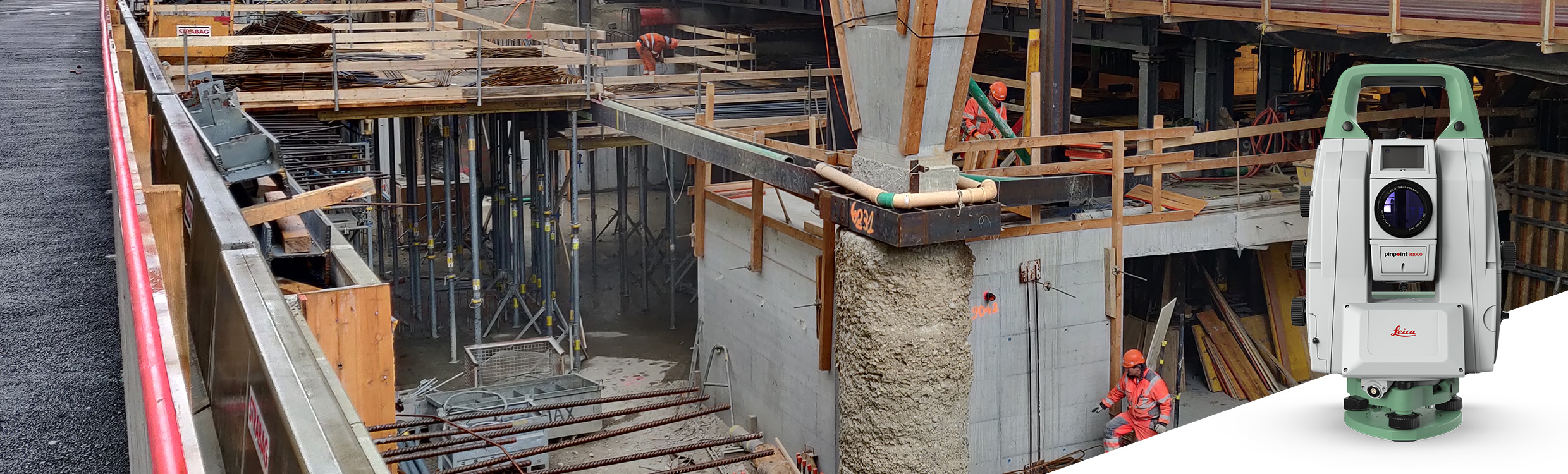
Leica Nova TM60
The first self-learning monitoring total station. The Leica TM60 total station is a next-generation surveying instrument designed to offer unprecedented precision and efficiency in the field of surveying and cartography. This tool is the perfect choice for professionals seeking the highest quality in measurements and map creation.
The Leica TM60 features an advanced reflectorless measurement system, allowing high-precision measurements at extremely long distances. Furthermore, its automatic pointing technology ensures accurate measurements even in low-visibility conditions.
Moreover, it boasts a wide range of functions and features that make its use extremely easy and efficient. Its high-resolution colour touchscreen allows for a clear and detailed visualisation of data and measurement results.
Request more information
Leica Nova TM60 Total Station
The Leica Nova TM60 is a surveying powerhouse for all types of monitoring projects, especially when safe and continuous data collection is required. It comes with a firm promise: real-time information and reports you can always rely on, helping you make informed decisions on time and ahead of time.
Whether it is settlements, deflections, movements, landslides, or any other change in state, you will have everything under control 24/7. The TM60 features the ATRplus automated pointing system with the longest range in the world, half-second pointing accuracy, advanced imaging, and continuous operation.
The instrument reveals its full potential when paired with the Leica GeoMoS monitoring solution. This combination allows for a reaction to the complex demands of any monitoring project, whether continuous or campaign-based. The TM60 Monitoring Total Station is capable of automatically adapting to changing environmental conditions, providing peace of mind that no data gaps, downtime, or unexpected costs will occur.
The instrument comes with the powerful and intuitive field software, Leica Captivate. Easy-to-use touch technology and intuitive apps allow the user to carry out monitoring campaigns effectively.
It features a high-capacity internal data storage system, which allows a vast amount of information to be saved securely and in an organised manner. Other standout features of the Leica TM60 total station include its ability to perform horizontal and vertical angle measurements with an accuracy of up to 0.5 arc seconds, its reflector distance measurement system allowing measurements up to 10,000 metres, and its ability to work in extreme conditions, such as high humidity or temperature extremes.
The Leica TM60 total station is an essential tool for professionals seeking the highest quality in data collection and mapping. Its advanced technology and features make it a market leader in surveying and cartography.
The robust, precise, and durable Leica Nova TM60 robotic total station assists you in monitoring projects whenever safe and continuous data acquisition is needed. Real-time information and reports you can always trust to help with decision-making.
When to use the Leica Nova TM60
- Permanent monitoring (24/7): remote operation, continuous monitoring, real-time measurement data, resistant to diverse environmental conditions.
- Campaign monitoring (periodic): flexible instrument setup, automated measurements, Leica Captivate field software, dedicated monitoring app, connectivity to cloud services.
- Buildings and structures: monitoring of buildings, skyscrapers, industrial and sports facilities, and coastal or underground structures.
- Transport infrastructure: monitoring of tunnels, railways, bridges, roads and motorways, airports, ports, and canals.
- Environmental monitoring: monitoring of landslides, rockfalls, and subsidence.
- Energy infrastructure: monitoring of dams, oil and gas plants, nuclear facilities, pipelines, or power stations.
- Mining: monitoring of slope stability, retaining walls, and excavations.
Minimising downtime
The Leica Nova TM60 has been designed to offer the peace of mind of uninterrupted operation, longer maintenance intervals (annual), and the absence of data gaps thanks to Leica GeoMoS Edge.
ATRplus
The Leica Nova TM60 has become the world’s first self-learning monitoring total station thanks to the introduction of ATRplus. ATRplus enables advanced automation and optimal measurement performance (up to 3000 m), without the need for adjustments to environmental conditions.
Leica GeoMoS
The automatic deformation monitoring system from Leica Geosystems helps you understand and react quickly to the complex demands of monitoring projects with the flexibility they require.
Self-learning total station
This GeoMoS feature allows the instrument to automatically search, aim, and monitor prisms with the expanded ATRplus field of view. The detection of prisms to be monitored can now be performed automatically and remotely.
For a more convenient experience, take advantage of Leica Geosystems’ Active Customer Care. Our global network of experienced professionals is just a click away to offer the assistance you require with any issue. Additionally, you can control your costs with a personalised Customer Care Package (CCP), giving you peace of mind knowing you are protected anywhere, at any time.
