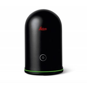
Leica ScanStation P40
Versatile high-speed laser scanner.
Integrated 3D laser scanning solution providing unprecedented speed, accuracy, and range for demanding scanning projects.
Request more information
Leica ScanStation P40 Laser Scanner
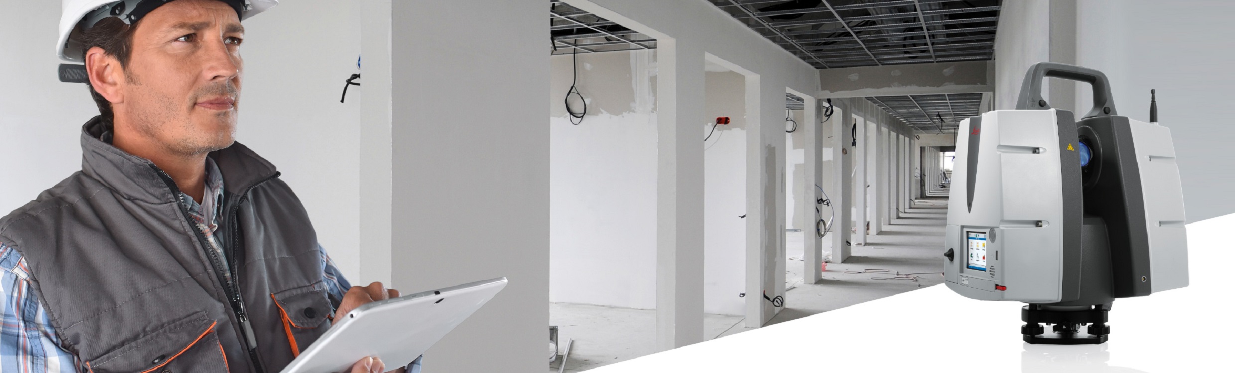
The Leica ScanStation P-Series 3D laser scanners are ideal for capturing 3D geometry of civil infrastructure, creating as-built representations of large industrial complexes, reconstructing crime scenes, or generating 3D data for integration into Building Information Modelling (BIM).
They deliver high-quality 3D data and High Dynamic Range (HDR) imagery at an incredibly fast scanning speed of 1 million points per second with ranges of up to 270m. Unsurpassed range and angular accuracy, low noise levels, and a dual-axis compensator form the foundation for highly detailed 3D colour point clouds with real-world clarity.
Leica Geosystems 3D laser scanners provide:
- Highest quality 3D data and HDR images
- Extremely fast scanning speed of 1 million points per second
- Ranges of up to 1,200 m
- Low noise level
- Survey-grade dual-axis compensator
- Highly detailed 3D colour point clouds with real-world clarity
The Right Choice for Scanning
Whether you need a detailed as-built representation of a façade, a 2D floor plan, 3D data for integration into BIM software, or high-definition scan data for topographic maps and as-built surveys of roads, railways, tunnels, and bridges, you know you need a long-range scanning tool. The Leica ScanStation P30/P40 scanners are the right choice because every detail matters.
High-Performance Terrestrial Scanner
These exceptionally durable 3D laser scanners reduce downtime and operate even in the most demanding environmental conditions, such as temperatures ranging from –20 °C to +50 °C. Additionally, they are IP54-rated for dust and water resistance.
Complete Scanning Solution
Leica Geosystems offers the ScanStation series as an integral part of a complete scanning solution including hardware, software, services, training, and support. 3D laser scanner data can be processed in the industry-leading 3D point cloud software suite, consisting of Leica Cyclone standalone software, Leica CloudWorx plug-in tools for CAD systems, and the free Leica TruView software.
ScanStation P30/P40 Offers
- Highest quality 3D data and HDR imagery
- Extremely fast scanning speed of 1 million points per second
- Range of up to 270 metres
- Very low noise levels
- Survey-grade dual-axis compensator
- Highly detailed 3D colour point clouds with real-world clarity