Leica RTC360
The Leica RTC360 is a high-speed 3D laser scanner designed for professionals who need to capture reality with maximum precision in the shortest possible time. It combines ultra-fast scanning, HDR imagery, and automatic field registration to provide reliable, complete point clouds ready for work from day one.
Request more information
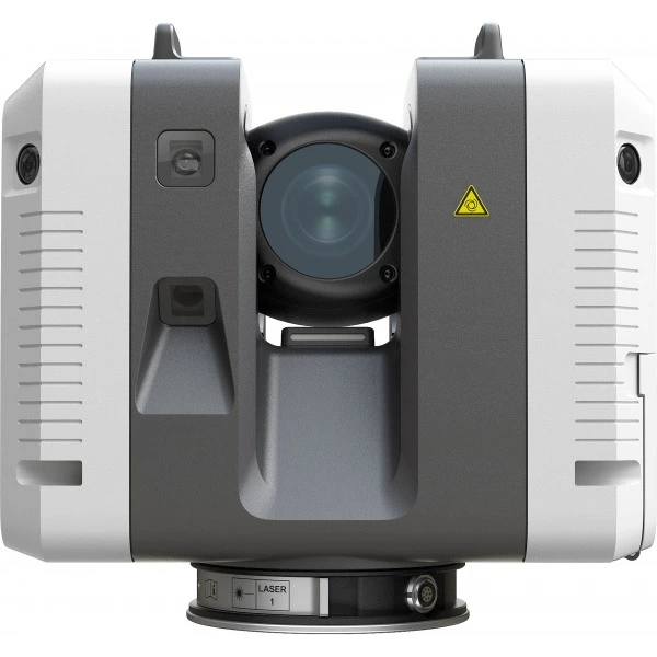
Leica RTC360 3D Laser Scanner
The Leica RTC360 is the most advanced laser scanning solution from Leica Geosystems, the leader in 3D laser scanning and measurement technology. Designed for architecture, engineering, and construction professionals, the RTC360 offers exceptional speed and precision in capturing three-dimensional data. With its high-speed laser scanning system, the RTC360 can scan large areas and objects in minutes, allowing professionals to save time and reduce costs on their projects.
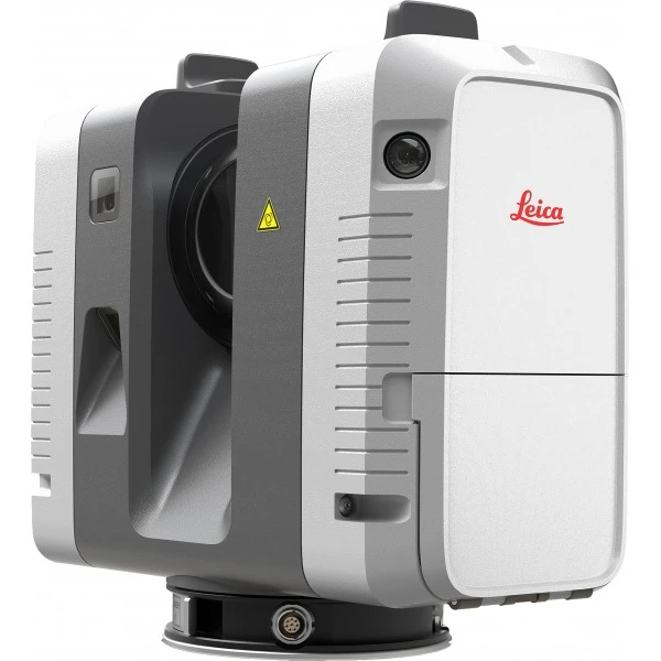
![]()
Thanks to its ability to capture up to 2 million points per second, the RTC360 drastically reduces field time without compromising accuracy. Each scan is completed in just seconds, allowing large surfaces to be covered in a single day while minimising interruptions in operational environments or occupied buildings.
One of its major differentiators is the integration of automatic field registration systems. Using inertial sensors and internal cameras, the scanner can automatically pre-register stations as the project progresses. This not only speeds up subsequent office work but also reduces errors and provides greater security in point cloud alignment.
The integrated HDR camera system allows for high-quality spherical images, which are combined with the point cloud to offer a 3D model rich in visual information. This is particularly useful in BIM projects, heritage documentation, forensic analysis, or building refurbishment, where visual context is key for decision-making.
The Leica RTC360 also stands out for its portability and ease of use. Its low weight and intuitive handling make it an ideal tool for both experienced technicians and teams looking to adopt laser scanning without unnecessary complexity. Furthermore, its workflow is optimised to integrate naturally with processing and modelling software, facilitating a smooth transition from field to office.
- Truly portable, fully automated, intuitive, and designed for maximum productivity. It efficiently combines the high-performance RTC360 3D laser scanner with the Leica Cyclone FIELD 360 mobile app for automatic real-time scan registration, and Leica Cyclone REGISTER 360 office software to seamlessly integrate your 3D model into your workflow.
- Scan and capture reality, including High Dynamic Range (HDR) imagery, in less than two minutes.
- Automatically record your movements from station to station to pre-register your scans in the field without any manual intervention.
- Enrich your data capture with information tags that illustrate all details for better planning, reflect site reality, and allow your team to gain true situational awareness.
Scanning Speed
The Leica RTC360 3D laser captures reality faster than ever. With a measurement rate of up to 2 million points per second and an advanced HDR imaging system, a complete point cloud acquisition can be performed in under 2 minutes.
Additionally, it incorporates intelligent video cameras (VIS Technology) that track known common positions and directly perform scan alignment, even when moving between rooms or changing floors. Immediate data transfer from field to office ensures maximum productivity.
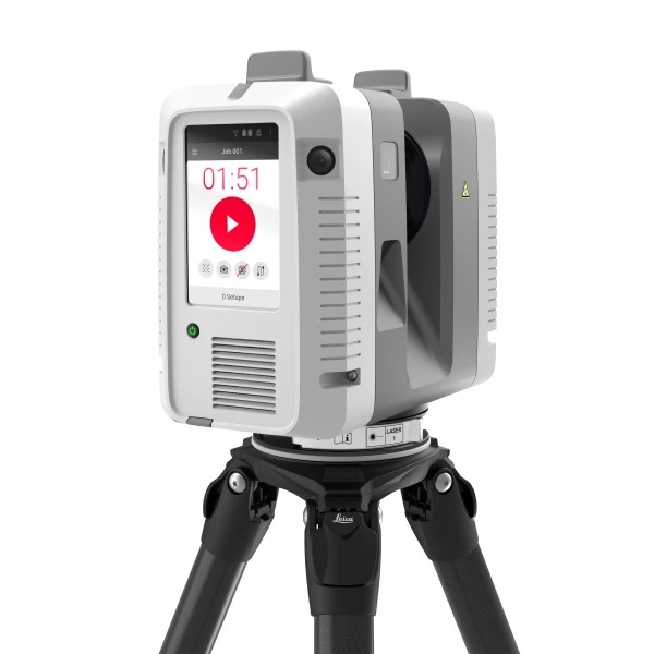
Lightweight and Robust Scanner
Featuring a minimalist, lightweight, and robust design, it includes a foldable tripod compact enough to fit with the RTC360 3D into a standard backpack. The tripod features mechanisms for rapid setup without sacrificing stability. Once ready, scan simply with the press of a single button.

Scanning Precision
Capture point clouds with lower noise accompanied by HDR images, resulting in sharper, higher-quality scans. In combination with the Cyclone FIELD 360 app, point cloud registration is performed automatically, offering real-time point clouds with exceptional accuracy that can be verified on-site.
In-Field Pre-registration
As part of the Leica Geosystems 360 reality capture solution, the high-performance Leica Cyclone FIELD 360 mobile app is the best on-site companion for the 3D laser scanner. With its intuitive user interface, remote scan control, and on-site point cloud display, navigation is a breeze, even for inexperienced users.
In summary, the Leica RTC360 is an essential tool for any professional needing to capture three-dimensional data quickly, accurately, and efficiently. With its combination of speed, precision, and advanced features, the RTC360 is the ideal choice for any 3D construction, design, or inspection project.
Additional information
| Scope | Up to 130 metres |
|---|---|
| Accuracy - distance | ±1.9 mm at 10 m |
| Accuracy – positioning | ±6 mm to 10 m |
| Scanning speed | Up to 2 million dots per second |
| Field of view | Horizontal: 360° |
| Minimum angular resolution | 0,009° |
| Field registration | Automatic registration via VIS (without targets) |
| VIS system | Integrated cameras and IMUs for automatic tracking between stations |
| Autonomy | Up to 4 hours of use |
| Weight (including battery) | Approximately 5.35 kg |
| Operating range | 0 °C to +40 °C |
| Levelling system | Automatic levelling |
| Storage | Internal memory + external USB |
| Connectivity | Built-in Wi-Fi |
| Data format | High-density 3D point clouds |
| Scan time | Full scan in approximately 2 minutes |
| Colourisation | Realistic HDR from spherical images |
| Built-in camera | Built-in HDR camera for capturing spherical images |
| Image resolution | Up to 432 MP (spherical image) |