
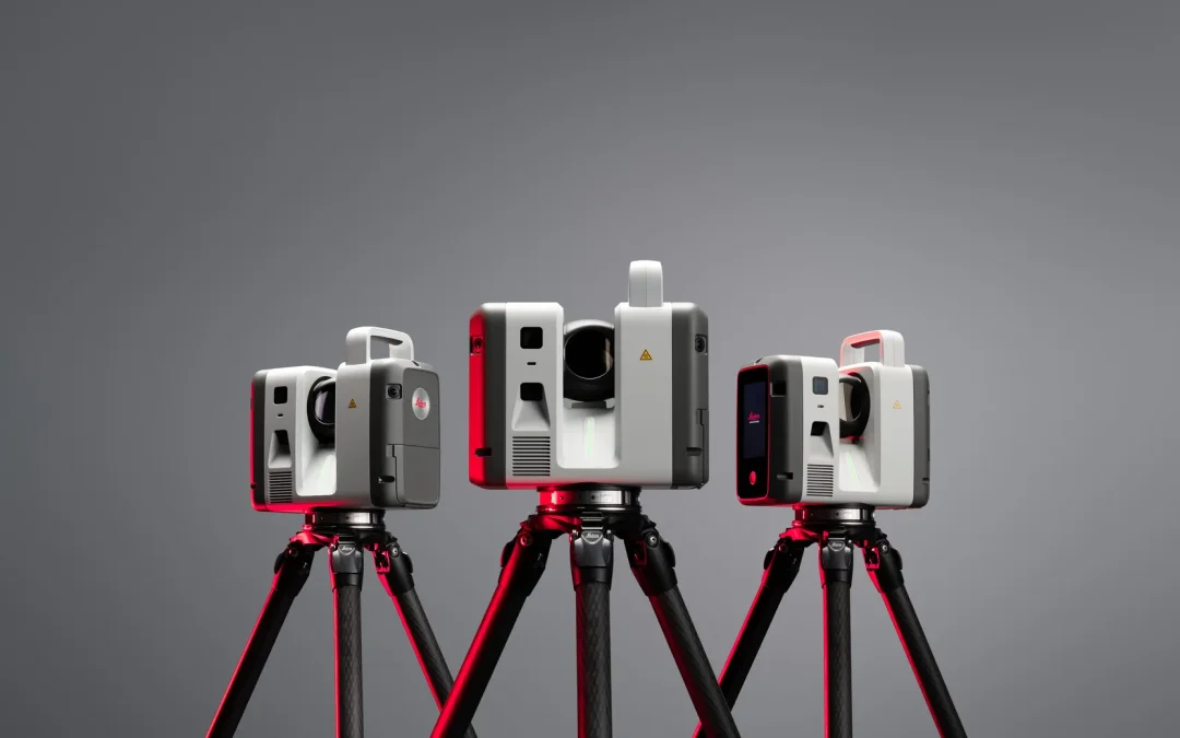
The Leica RTC Series is the new range of terrestrial 3D laser scanners introduced by Leica Geosystems (Hexagon) on 9 June 2026, consisting of three models (RTC300, RTC500 and RTC700), replacing the RTC360 and RTC360 LT ranges and the ScanStation P30/P40/P50. All three share the same technology platform and differ mainly in range, capture speed and resolution, allowing each scanner to cover everything from construction and BIM projects to large-scale industrial surveys. In this article, we explain what each model offers, its real technical specifications and how to choose the right one according to your type of project.
Some key points from this new launch:
- The RTC Series brings together in a single platform what used to be two separate ranges: the speed of the RTC360 and the robustness of the ScanStation P-Series.
- All three models share the same core technology: Class 1 1550 nm laser, 360° x 300° field of view, angular accuracy of 10 arc seconds and distance accuracy of 1.2 mm + 10 ppm.
- The main difference between models is the range: 85 m (RTC300), 130 m (RTC500) and 270 m (RTC700), measured on low-reflectivity surfaces.
- They include Livelink, a Leica Cyclone FIELD 360 feature that sends data to Hexagon GeoCloud in real time during capture.
- It is possible to scale from one model to another without replacing the entire system, making progressive investment easier.
Request more information with no obligation
What is the Leica RTC Series and why does it represent an important change?
The Leica RTC Series is a family of 3D laser scanners that directly replaces two product lines that were previously sold separately: the Leica RTC360/LT, focused on speed and portability, and the ScanStation P30/P40/P50, focused on accuracy and range for large projects. Instead of two ranges with different architectures, Leica has developed a single scalable platform with three performance levels.
This has a direct practical implication for any company considering renewing its scanning equipment : it is no longer necessary to choose between “speed” or “industrial range and accuracy” as if they were two separate worlds. The three models (RTC300, RTC500 and RTC700) are based on the same software and firmware foundation, so the field and office workflow is identical regardless of the model used.
According to Leica Geosystems, the new RTC Series captures data up to 35% faster and with greater accuracy than the closest competing scanner on the market, reaching up to 2,000,000 points per second on the RTC500 and RTC700 models.
The three models: RTC300, RTC500 and RTC700
Each of the three RTC Series models is designed for a different project profile, although they all share the same technology base. The choice between them mainly depends on the range your regular work requires and the type of environment in which you operate.
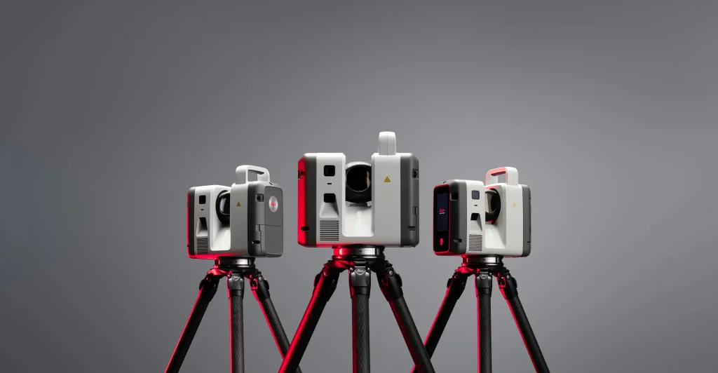
Leica RTC300: for construction and indoor projects
The RTC300 is the entry-level model in the range and is designed for agile reality capture in building construction and fast-moving project environments. Its range reaches up to 85 metres (on surfaces with 32% reflectivity), and it captures up to 1,000,000 points per second.
It is the natural choice for architecture studios, Scan-to-BIM companies or teams working mainly indoors and on renovation projects, where an 85-metre range is more than enough and the priority is capture speed per room. Leica explicitly presents it as the entry point to the RTC Series, with the possibility of scaling up to a higher model if project volume or type grows.
Leica RTC500: the balanced option for surveying and infrastructure
The RTC500 is designed for surveying, construction, infrastructure and public safety teams that need to adapt to changing project conditions. It reaches 130 metres (on surfaces with 8% reflectivity) and, like the RTC700, captures up to 2,000,000 points per second.
Functionally, it is the most similar to the former RTC360 in terms of workflow, including basic resection workflows, but with the range and capture performance of the high-end range. It is the most versatile option for companies covering both civil works and medium-sized topographic surveys, and will probably be the model with the highest demand in the general professional segment.
Leica RTC700: maximum capability for infrastructure and industry
The RTC700 is the highest-performance model in the range, designed for large-scale infrastructure, industrial plants and complex survey environments. Its range reaches 270 metres (on surfaces with 3.5% reflectivity), and in addition to maintaining 2,000,000 points per second, it improves resolution: 1.6 mm at 10 metres compared with 3 mm on the other two models, with an area scan mode reaching 0.8 mm at 10 metres.
It is the natural replacement for the ScanStation P40/P50 for companies working in industrial plants, linear infrastructure (roads, railways, bridges) or projects requiring large-scale coordinated multi-scanner workflows.
Technical specifications: RTC300 vs RTC500 vs RTC700 comparison
All models share a common technology base: time-of-flight telemetry with waveform digitisation, invisible Class 1 1550 nm laser, 360° x 300° field of view, angular accuracy of 10 arc seconds and distance accuracy of 1.2 mm + 10 ppm. The following table summarises the key differences between the three models.
| Feature | RTC300 | RTC500 | RTC700 |
|---|---|---|---|
| Usage profile | Indoor construction and BIM | Surveying, infrastructure, public safety | Industry, large-scale infrastructure |
| Maximum range | 85 m (32% reflectivity) | 130 m (8% reflectivity) | 270 m (3.5% reflectivity) |
| Capture speed | Up to 1,000,000 pts/s | Up to 2,000,000 pts/s | Up to 2,000,000 pts/s |
| Resolution | 3 mm at 10 m | 3 mm at 10 m | 1.6 mm at 10 m / 0.8 mm in area mode |
| Distance accuracy | 1.2 mm + 10 ppm | 1.2 mm + 10 ppm | 1.2 mm + 10 ppm |
| Full scan time with HDR (6 mm at 10 m) | ~2 min 30 s | ~1 min 40 s | ~1 min 40 s |
| Livelink / cloud connection | Included | Included | Included |
| Multi-scanner work | From single scanner to scalable | Compatible | Advanced, large-scale |
| Replaces | RTC360 / RTC360 LT | RTC360 / ScanStation P30 | ScanStation P40 / P50 |
Livelink: the most relevant workflow change in the RTC Series
Beyond the hardware improvements, the new feature with the greatest day-to-day impact is Livelink, a function integrated into Leica Cyclone FIELD 360 that transmits scan data to Hexagon GeoCloud while it is being captured, in real time.
Until now, the usual workflow was: scan in the field, return to the office, import and register the data, and only then share it with the rest of the team or the client. Any coverage gap or registration issue would be discovered days later, when the team had already dismantled the equipment and left the site.
With Livelink, several scanners can feed the same cloud project simultaneously, and both the field team and the office team can see the coverage while scanning is taking place. This makes it possible to detect uncovered areas or registration problems before moving the tripod, avoiding additional site visits, something especially valuable in projects with high access costs (industrial plants, infrastructure, civil works with access restrictions).
The Cyclone FIELD 360 app remains the field interface for visualisation, configuration and tagging, while synchronisation with GeoCloud takes place in the background.
Which RTC model should you choose according to your project?
The choice between RTC300, RTC500 and RTC700 depends mainly on two factors: the range you usually need and whether you work with one or several scanners in parallel.
| Project type | Recommended model | Why |
|---|---|---|
| Interior design, renovation, building Scan-to-BIM | RTC300 | 85 m range is sufficient for interiors, maximum agility and a more accessible entry cost |
| General surveying, civil works, urban infrastructure | RTC500 | Balance between range (130 m), speed (2M pts/s) and versatility for different environments |
| Industrial plants, linear infrastructure, large areas | RTC700 | 270 m range and maximum resolution for demanding environments and multi-scanner workflows |
| Companies that already have RTC360 or RTC360 LT | RTC300 or RTC500 | Direct upgrade path while maintaining a similar workflow |
| Companies that already have ScanStation P30 | RTC500 | Direct replacement with improvements in speed and connectivity |
| Companies that already have ScanStation P40/P50 | RTC700 | Direct replacement while maintaining high-end accuracy and range |
An important aspect to consider when deciding is that all three models share the same platform: if a company starts with an RTC300 for indoor projects and later needs to cover longer-range work, it can move up to an RTC500 or RTC700 without having to rebuild its workflow or retrain the team from scratch.
Availability of the Leica RTC Series in Spain
As an official Leica Geosystems distributor in Spain and Portugal, Global Geosystems has been working with the new RTC Series range since its launch. Our technical team, led by Álvaro Barrio (Metrology Technical Director), is evaluating the three models to provide first-hand information about their performance in real environments — something especially relevant given that this is a very recent launch and there is still little field data available in the Spanish market.
If your company is considering upgrading from an RTC360, a ScanStation P-Series, or simply adding a 3D laser scanner for the first time, we can help you identify which RTC model best suits your type of projects, with direct technical advice and no call-centre intermediaries.
Frequently asked questions about the Leica RTC Series
Does the Leica RTC Series replace the RTC360?
Yes. The RTC Series replaces both the RTC360 and RTC360 LT as well as the ScanStation P30/P40/P50 range, unifying both lines into a single platform with three performance levels (RTC300, RTC500 and RTC700).
What is the main difference between the RTC300, RTC500 and RTC700?
The main difference is range: 85 m for the RTC300, 130 m for the RTC500 and 270 m for the RTC700 (measured on low-reflectivity surfaces). The RTC500 and RTC700 also double the capture speed of the RTC300 (2 million points per second versus 1 million), and the RTC700 adds higher resolution.
What is Livelink and what is it used for?
Livelink is a Leica Cyclone FIELD 360 function that transmits scan data to Hexagon GeoCloud in real time during capture, allowing several scanners to feed the same project and enabling the office team to see coverage while the field team continues working.
Can I start with an RTC300 and later switch to an RTC500 or RTC700?
Yes. The three models share the same platform and software, so it is possible to scale up to a higher-performance model without having to replace the entire system or change the team’s workflow.
When will the Leica RTC Series be available in Spain?
Leica Geosystems announced the launch of the RTC Series on 9 June 2026. At Global Geosystems, as official distributors, we are already managing availability of the three models for the Spanish and Portuguese markets.
What accuracy do the RTC range scanners offer?
All three models share a distance accuracy of 1.2 mm + 10 ppm and an angular accuracy of 10 arc seconds. In terms of resolution, the RTC300 and RTC500 offer 3 mm at 10 metres, while the RTC700 improves this to 1.6 mm at 10 metres (0.8 mm in area scan mode).