Leica C-Thrue
The Leica C-Thrue concrete scanner is a high-tech solution for non-destructive inspection of concrete and masonry structures. With advanced radar imaging technology, it allows users to easily detect hidden objects such as reinforcement bars, electrical cables and pipes within walls and floors. Its ergonomic design and ease of use make it ideal for construction, building inspection, maintenance and repair applications.
Request more information
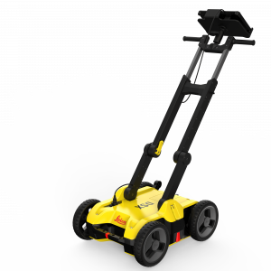
C-Thrue Concrete Scanner
The C-Thrue concrete scanner is a robust and easy-to-use solution designed to see through concrete structures and reveal real data for optimal decision-making. It is suitable for all construction sites and operations, including building renovation surveys, overpasses, monuments, bridges and tunnels, as well as detailed analysis of the original engineering design and comparison with the as-built structure.
C-Thrue offers greater flexibility without limitations for your inspection requirements, thanks to its compact and lightweight telescopic pole and external controller, which can be easily transported and used on-site even in difficult conditions (e.g. under ceilings, on floors, on walls, etc.).
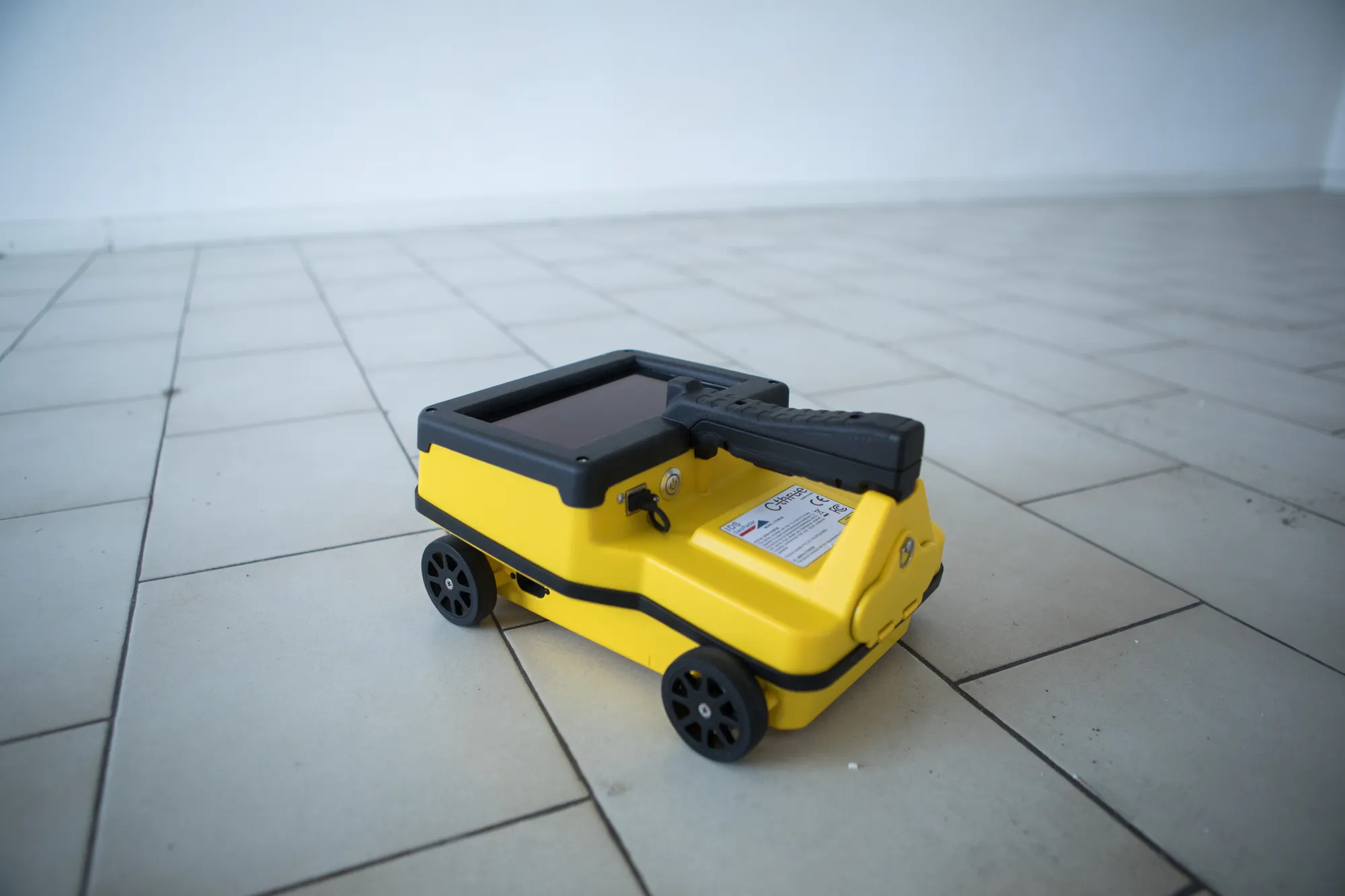
The C-Thrue external controller enables faster and easier data interpretation thanks to real-time processing and augmented reality visualisation, allowing for more effective decision-making.
![]()
Features and benefits of C-Thrue
Complete and efficient structural inspection
Detection of both first and second layers of reinforcement, post-tension cables, electrical wiring and voids, thanks to dual-polarisation antenna technology.
Safe drilling in inspected structures
Automatic detection of reinforcement and voids improves safety before cutting or drilling into concrete.
Fully visible multitouch display
The data displayed on screen is never obstructed by the handle or the user’s hand.
Simplified data interpretation
Optimal decision-making through visualisation of acquired data in 3D models.
Higher data accuracy
Automatic positioning and navigation system.
Advanced data visualisation
Augmented reality allows 3D data visualisation and sharing between operators, in real time or after acquisition.
Flexibility anywhere
Lightweight, compact and portable system suitable for any site or operator.
See through concrete structures and reveal real data.