Leica Pegasus: Two Ultimate
Mobile sensor platform Leica Pegasus: Two Ultimate.
High-quality 360° imagery calibrated to point clouds for smart city applications.
Request more information
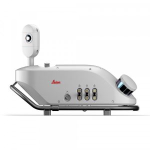
Leica Pegasus:Two Ultimate
Leica Pegasus:Two Ultimate is the updated version of the reliable Leica Geosystems Pegasus:Two mobile mapping platform. This new version eliminates the need to combine six cameras by incorporating two complementary cameras that create a 360° image of 24 MP calibrated for LiDAR profiler data, enabling reality capture from a vehicle, train or boat. To speed up office processing, the removable SSD allows you to simply extract your data and take it to the office.
The new Leica Pegasus:Two Ultimate allows you to get more out of your day, as you can capture data under various lighting conditions and at different vehicle speeds. The higher sensor-to-pixel ratio and dual light sensor enable a greater dynamic range. Image quality and photogrammetry improve thanks to the higher resolution of the 12 megapixel (MP) side camera and integrated JPEG compression.
Compared to the Pegasus:Two, the front and rear cameras have been removed, as photogrammetry measurements achieved from these positions are no longer necessary in the updated system due to the geometry of possible stereo pairs.
- Side cameras offer 8 FPS at 12 MP, with 61° x 47° FOV on each side camera.
- The maximum pixel size at 10 m is 3 mm.
- The adjustable pavement camera with 12 mm lenses allows capturing images of the desired area on a road or tunnel.
![]()
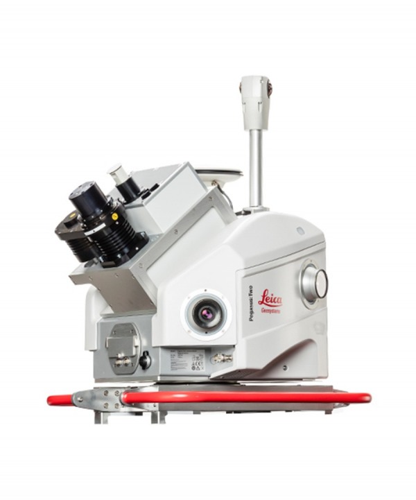
360° camera
The new 24 MP 360° camera system provides seamless panoramic images. The telescopic pole allows easy storage of the device and prevents damage to the camera head. The 360° camera data can be used to colourise the point cloud. The 360° image and the point cloud can be viewed overlaid.
City digitalisation
The digitalisation of city infrastructure, planning and resources forms the foundation of a smart city. The Pegasus:Two Ultimate platform allows you to grow and offer the best solution for this market. High-quality 360° images calibrated to the digital point cloud enable you to provide easily acquired data for a future with autonomous vehicles.
Data sharing
Use the new Leica Pegasus:WebViewer to access and share data anytime and anywhere. The software allows visualising, delivering and billing captured data stored in the cloud more quickly. The system enables point cloud rendering in any browser without the need for additional plugins for navigation and measurement.
Greater flexibility
With more sensor expansion ports available, you can enjoy additional ways of capturing the city in digital form by connecting more sensors. You can also save even more time with an industrial, removable hard drive with USB 3.0, allowing the user to store data directly on it and connect it to any PC or server with a USB 3.0 interface.