Leica Pegasus Backpack
Leica Pegasus: Backpack The wearable mobile mapping solution.
This award-winning portable data capture system, worn by the user, collects data indoors, outdoors and underground.
Request more information
Leica Pegasus Backpack. The wearable mobile mapping solution
This award-winning wearable data capture system collects data indoors, outdoors and underground.
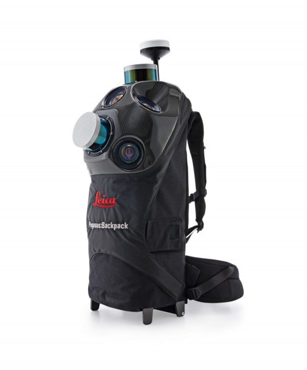
Leica Pegasus: Backpack is a portable data capture system that has received multiple awards. Its ergonomic design combines five cameras and two LiDAR profilers, all housed in an ultra-light carbon fibre casing. It enables comprehensive documentation indoors and outdoors with a high level of accuracy.
This unique mobile mapping solution has been designed for fast and simple data capture. It is fully portable, allowing it to be checked in as luggage on a flight. Pegasus: Backpack has been designed to act as a mobile data capture platform (point clouds and imagery) and also includes external ports for synchronising additional sensors.
![]()
BIM – capture indoors, outdoors, underground, anywhere
Pegasus Backpack makes professional BIM documentation a reality. It synchronises imagery and point clouds, ensuring complete building documentation for full lifecycle management. By using SLAM technology (Simultaneous Localisation and Mapping) and a high-precision IMU, it guarantees accurate positioning where GNSS is not available.
Industrial training - reality-based information for rapid response
Knowing and understanding an area before taking action in emergency situations can save lives. Document any location with 3D models and imagery for a fast, safe and efficient response. In combination with Autodesk, Intergraph or other software, training in the industrial sector is improved by providing more reliable and accurate datasets.
Safety - informed decisions in emergency situations
In emergency situations, Pegasus Backpack helps you make faster decisions thanks to access to more accurate data. Evacuation plans include clear and detailed images and point clouds that alert authorities to any changes. Access densely populated areas, providing accurate and up-to-date mapping to give city authorities a clearer and deeper understanding of the situation.
Natural disaster response: minimise damage and save lives
For the first time, personnel involved in disaster response can capture 3D data of the affected area on foot. A faster response time translates into saving lives and minimising damage. Capture the necessary data to make better and faster decisions, increasing the chances of survival and reconstruction.


